Bonjour. les cartes de pollution lumineuse de cette page ne seront plus mises à jours. Merci d’aller sur les pages de la pollution lumineuse européenne
http://www.avex-asso.org/dossiers/wordpress/?page_id=2737
Hello. light pollution maps on this page will not be updates . Thank you to go to the pages of the EUROPEAN light pollution
http://www.avex-asso.org/dossiers/wordpress/?page_id=2754
All text and pictures are copyrighted © AVEX 2010

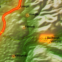
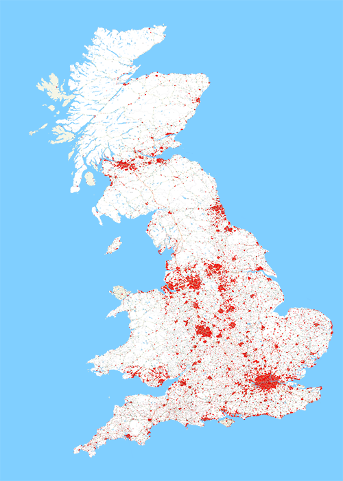
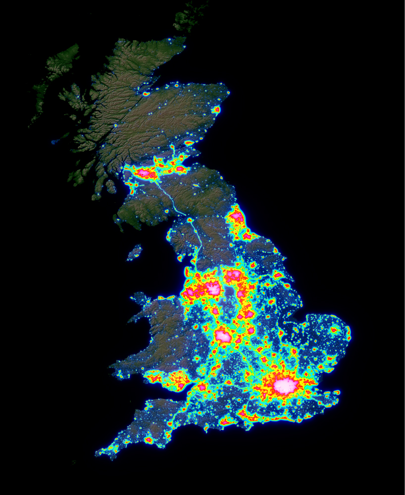
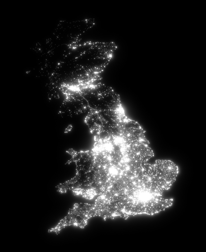
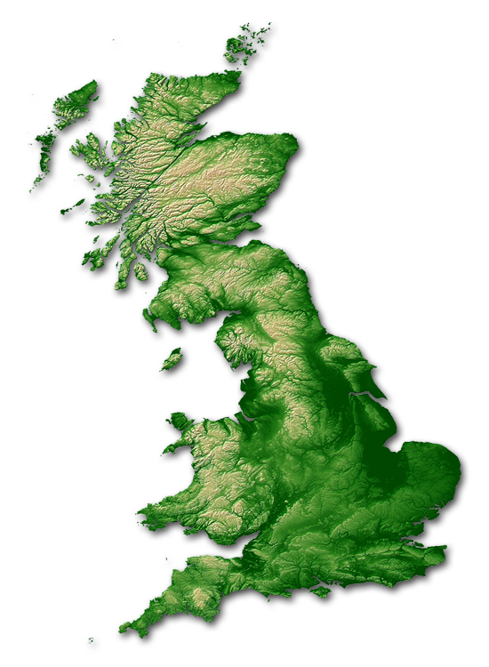
Here are the map of light pollution of a part of the United Kingdom.
Some thoughts …
I focused the job on the main island. Ireland is, for the time being, not yet rendered. England, Scotland and Wales are covered by the map of light pollution.
I rendered maps in different folowing ways
A-« Color scale » map
Visual observation light pollution map + topography + relief

—
Light pollution map + without typo

—
Map for astrophoto & CCD
—
B- PDF « Sodium »
Light pollution map + topography + relief (for public demo)

—
- « Color scale » light pollution map (KMZ file)
- C- Google Earth files
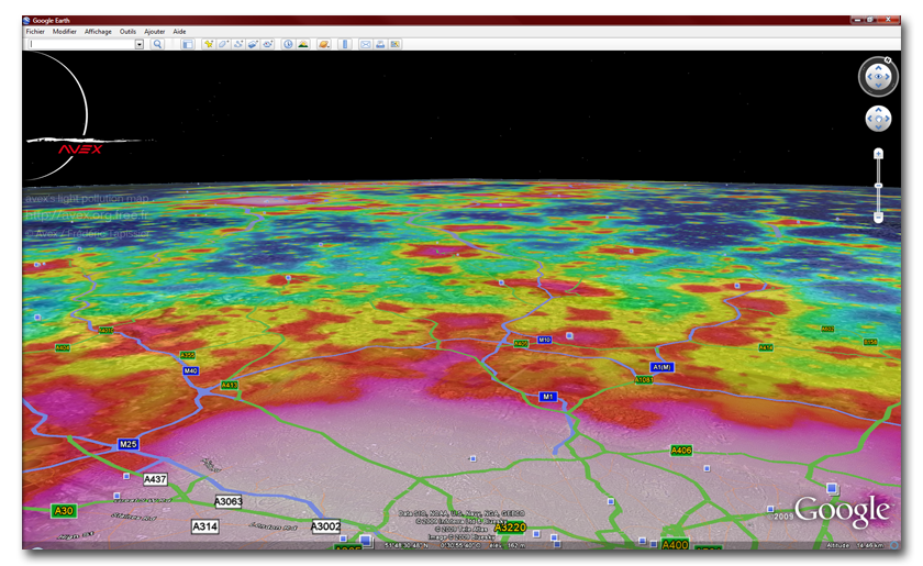
Télécharger le Fichier KMZ compatible avec Google earth
Following recent advances in data management, maps in Google Earth have significantly improved their positioning precision.
Anytime, urbanization datas I have are relatively incomplete, missing some small villages that have _after checking_ urban lighting! So, in rural areas, some sources of light pollution are not on maps. I’m sorry but
right now I have no way to do otherwise.
—+++|||+++—
These maps are absolutely free, however this takes time and required hardware to build them. Any donation will be greatly appreciated (€ , £ or $)
Paypal donation

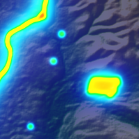
White : 0-15 visible stars (without planets) according to the conditions. Very high level of light pollution and all around. Typical of big urban centre and big regional and national cities.
—
Magenta: 25-80 visible stars. Principles constellations began to be recognizable.
—
Red: 80-150 stars : constellations and others stars appears. In a telescope, Some Messier object began to be observable.
—
Orange: 150-250 stars in good conditions. The light pollution is present all around but some darks areas appears. Typicaly the middle suburbs.
—
Yellow: 250-500 stars. Strong light pollution but the Milky Way can appear in good conditions. Some Messiers among the most bright can be visible with the necked eye.
—
Green: 500-1000 stars : far peacefull suburbs, Milky Way many times visible but very sensitive to the atmospheric conditions. Typicaly, the glare of light pollution take a large place in the sky and reach at 40-50° of elevation.
—
Cyan: 1000-1500 stars. The Milky Way is visible most of the time in fonction of climatic conditions but without contrast.
—
Blue: 1500-2000 stars. Good sky. The Milky Way is easily visible, we began to have the sensation of a good sky, but, some source of light pollution damage the sky and in a second time the sky by reflexion at the vertical of the observer.
—
Night blue : 2000-3000 stars. Very good sky. The Milky Way is present and powerfull. The light glares are far away and scaterred, they don’t affect the sky quality.
—
Black : (green by texture transparency) : more than 3000 stars. No light pollution problems revealable on the sky quality
Legal :
1 These maps are the exclusive property of Frederic Tapissier / AVEX or its beneficiary.
2 The author gives the authorization to diffuse THESE maps in a private context only.
3 The rights cannot be transferred by the user to Anybody and for any reason.
4 ANY print or diffusion REQUEST HAS to be APPROVED by Frederic Tapissier /AVEX.
5 No modification of the data, particularly the colors and the range of samples, the exploitation size of these maps cannot be operated without the authorization of Frederic Tapissier.
6 These PDF are protected by Copyrights and other electronic marks, and are protected against modifications and the exportations of the contained data.
7 The author cannot be considered as responsible of the use of this data in any way.
8 The author does not guarantee the precision of the data wich are approximative, the values are obtained arithmetically. This document cannot be considered as an official basis for any work, and declines any responsibility for past, present and future use and the interpretation of these data.
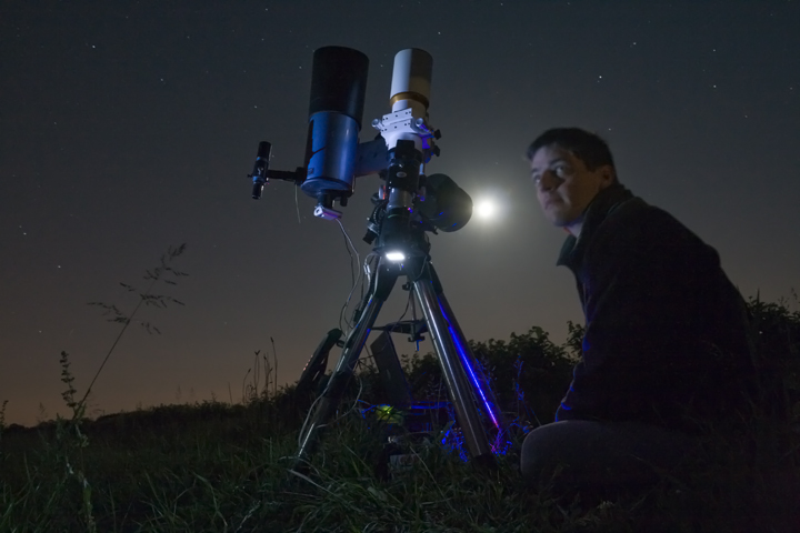
some picture from the work
about me….
Hi Frederic,
I am the chairman of the Thanet Astronomy Group.
We are a group that specialises in bringing astronomy to beginners in plain English.
We are based in (Thanet) North East Kent, England.
We have been looking for maps of this detail for some time.
We would like to include your maps on a dedicated page on our web site.
Would we be able to do this ?
How would you like it to be done ?
Danny
Yes you can use it but only the thrumbs (800pix x800pix max), not the full picture
please insert the avex website under your picture
Hi ,
Its possible to get the map for INDIA..?
No, sory, I’ve no data for this country
for Europe i use Corrine data land cover as layer for light pollution calculation, these datas does’nt exist for other country than Europe
As an amateur astronomer in the UK this is EXACTLY what I’ve been looking for, a thousand thankyou’s!
Hello,
I am an MSc student studying Countryside and Protected Area Management. As part of my dissertation I am involved in a local community partnership who are writing a planning document to protect a river estuary (the Deben Estuary) in Suffolk. My responsibility is to use GIS to generate maps for issues such as important bird areas, mammal records, wildlife sites, flood risk and, amongst others, light pollution. I have been using MAPINFO and Ordnance Survey data to do this, but am very keen on using your Light pollution map with Google Earth as one of the maps.
Is it possible to receive permission to use your software to generate a map on light pollution. Obviously I will reference you as the source at the bottom of the map.
Regards
Kieran O’Mahony
MSc Birkbeck College
Hi,
I have to say this is a very interesting article about light pollution!
I always wondered why we couldn’t see stars from some places and we had thousands in others!
Do you think you could make a light pollution map also for France??
It would be very instructive!
Thanks alot for all thoses informations and keep up the good work!
Kim from Montpellier
i kim
map for france and europe are already done 😉
Salut,
Puis-je avoir la permission d’utiliser la carte du Royaume-Uni La pollution lumineuse pour un plan d’affaires. Je l’ai trouvé sur votre websire. Je souhaite l’utiliser pour fournir un appui pour mon idée.
Merci beaucoup pour votre temps et asisstance
Wendy Selfe
Nice article, will subscribe for now and wait for some more =)